Peacebuilding Around Lake Albert
 AI
AILake Albert is where the peace between Uganda and the Democratic Republic of Congo gets tested. The lake forms a long stretch of their shared border, feeds tens of thousands of fishing households on both shores, and sits above one of the largest oil discoveries in East Africa. It is also a place where soldiers have shot at fishermen over an island whose ownership two governments still dispute.
Field research conducted around the lake in 2009 for the European Commission, with interviews in lakeshore communities, ministries and civil society on both sides, reached a conclusion that has aged well: the natural resources that make the Uganda DRC border conflict dangerous are also the most practical entry points for building peace across it. Fifteen years of oil development have raised the stakes on both halves of that sentence.
One lake, two shores, three economies
Lake Albert belongs to Africa’s Great Lakes and the upper Nile system. It runs about 160 kilometres long and averages 32 kilometres wide, fed mainly by the Victoria Nile and the Semliki River, with Uganda on its eastern shore and the DRC’s Ituri province on the west. The border runs through the water itself, and in places nobody agrees exactly where.
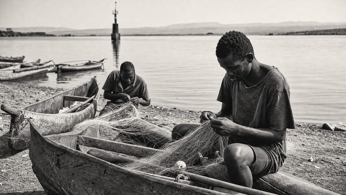
Livelihoods on both shores rest on the same three pillars: fishing, farming and cross-border trade. The lake has contributed around 15 percent of Uganda’s national fish catch, and border towns like Mahagi move timber, farm produce and fish in both directions. Communities are interwoven in ways borders do not capture. Some share tribal origins and languages such as Alur and Swahili, intermarriage is common, and Congolese residents have held local leadership positions in Ugandan lakeshore villages. Ituri’s economy points east: with no reliable road to western DRC, its goods exit to and through Uganda. That everyday interdependence, documented in this journal’s wider survey of regional cooperation in the Great Lakes region, is the raw material peacebuilders around the lake have to work with.
A heavy history: Ituri, occupation and the ICJ
The recent past weighs on all of it. Uganda invaded eastern Congo in 1996 and occupied Ituri from 1998 to 2003 during the Second Congo War, a period in which a local conflict over land and power escalated into massacres that killed tens of thousands. The International Court of Justice found in 2005, in Armed Activities on the Territory of the Congo (DRC v. Uganda), that Uganda had violated international law through its occupation and the plundering of Congolese resources, and in 2022 the court fixed reparations at US$325 million. After withdrawing, Kampala faced Congolese accusations of sheltering rebel groups near the lake; the FRPI militia continued to trouble southern Ituri, and mistrust between the two armies never fully dissolved. The broader war system these events belong to is examined in this journal’s analysis of the conflict in eastern DRC.
On the lake itself, geography keeps old wounds open. Rukwanzi Island, at the centre of prospective oil fields, is claimed by Uganda on colonial-era lines even though most of its inhabitants are Congolese. The Semliki River, which defines the border south of the lake, has shifted with erosion, moving land from one jurisdiction to the other. In 2007 and again in 2009, disputes around the island and the border produced kidnappings of fishermen and deadly shootings involving security forces. Small incidents on remote water can escalate precisely because two navies, two armies and two nervous governments stand behind them.
Fish: shared resource, shrinking stock
The lake’s fisheries show the whole problem in miniature. Researchers found stocks declining in diversity, volume and average fish size, driven by destructive and often illegal gear, breeding-ground damage and a steady influx of migrants with no alternative income. Regulation stopped at the waterline: Ugandan law banned gillnets under five inches on Lake Albert, while no equivalent rule existed on the Congolese side, and pre-war bilateral agreements on net sizes had become unenforceable. Uganda’s environment authority put the stakes bluntly:
The currently worrying status of fishery resources in the region would be greatly exacerbated by oil spills or pollution resulting from oil development activities.
Yet the same research recorded something hopeful: most disputes between Ugandan and Congolese fishermen were still settled peacefully through kinship and trading networks, an informal early-warning system that repeatedly stopped incidents from escalating. Formal cooperation existed to build on. The Lakes Edward and Albert Fisheries (LEAF) project, financed through the Nile Basin Initiative‘s NELSAP programme with African Development Bank support, introduced joint fisheries co-management and an integrated lake management plan, deliberately pairing resource management with conflict prevention.
Oil: the multiplier
Everything around Lake Albert changed scale when commercial quantities of oil were confirmed on the Ugandan side, with roughly two billion barrels announced by 2009 and exploration suggesting more beneath the lake itself. The find promised transformation and delivered, first, suspicion. Kinshasa feared Congolese oil would be drained from wells on Ugandan soil. Ugandan civil society feared a “second Niger Delta”: test drilling proceeded inside Murchison Falls National Park and the Kabwoya Wildlife Reserve with unresolved questions about toxic drilling waste, fishermen were barred from the water during seismic surveys without compensation, and local officials lacked the capacity to monitor companies operating far ahead of them in expertise and money.
Development has since moved from prospect to construction. TotalEnergies’ Tilenga project and the CNOOC-operated Kingfisher field anchor Uganda’s production plans, tied to a refinery and the East African Crude Oil Pipeline to the Tanzanian coast, a programme that has drawn sustained scrutiny from conservation and human rights groups. On the Congolese side, exploration of the lake’s western blocks has repeatedly stalled amid insecurity in Ituri. The asymmetry the 2009 research warned about, one shore pumping while the other waits, remains the region’s central political risk, and analysts have long argued that only negotiated arrangements over the shared reservoir, backed by transparency mechanisms such as the Extractive Industries Transparency Initiative, can keep it manageable. Presidential meetings and declarations of goodwill have accumulated; a binding joint framework for the shared reservoir has not.
What peacebuilding around the lake looks like
The research distilled its field findings into premises that still read as a practical checklist for donors and both governments.
- Build trust where it already exists. Kinship, trade and intermarriage across the lake are functioning peace infrastructure. Programmes should reinforce these ties rather than bypass them with new committees.
- Copy the conservation model. The Central Albertine Rift transboundary network, nurtured by the International Gorilla Conservation Programme around Virunga National Park, kept park authorities from all three neighbouring states meeting through the wars, and was formalised in 2009. It shows that technical cooperation with a neutral facilitator can survive political freezes.
- Manage symmetry. Cooperation collapses when one side captures the benefits. Joint fisheries rules, shared environmental data and eventually shared oil arrangements must be visibly mutual.
- Include everyone with a stake. Fishing communities, migrants, women traders, local councils and CSOs such as ACODE, AFIEGO and NAPE were doing the actual work of transparency and dispute resolution; excluding them turns agreements into paper.
- Stay conflict-sensitive. Every intervention around the lake, a park boundary, a drilling pad, a fisheries patrol, redistributes livelihoods and can ignite or defuse tension depending on how it is designed.
These lessons travel. They echo through this journal’s comparative work on regional environmental cooperation and its study of water cooperation in the Middle East, where shared resources likewise double as shared risks. Around Lake Albert the arithmetic is simple and unforgiving: two states, one lake, one reservoir of oil and one interconnected population. Cooperation is not a diplomatic nicety here. It is the only arrangement under which either shore prospers, and both governments have known it, without fully acting on it, for a long time.
Frequently asked questions
Where is Lake Albert?
Lake Albert lies on the border between Uganda and the Democratic Republic of Congo, in the western branch of the East African Rift. It is about 160 kilometres long and averages 32 kilometres wide, fed mainly by the Victoria Nile and Semliki River, and belongs to both the African Great Lakes and the upper Nile system.
Which countries share Lake Albert?
Two: Uganda on the eastern shore and the DRC, specifically Ituri province, on the western shore. The international border runs through the lake itself, and parts of it, including Rukwanzi Island and the shifting Semliki River boundary, remain disputed.
What is the Uganda DRC border conflict about?
It combines a heavy history, Uganda’s 1998 to 2003 occupation of Ituri during the Second Congo War, with live disputes over the lake border, Rukwanzi Island, fishing grounds and oil. Incidents have included kidnappings of fishermen and deadly shootings involving security forces, though full-scale interstate fighting has been avoided since 2003.
Why is Rukwanzi Island disputed?
The small island sits in the middle of prospective oil fields near the lake’s southern end. Uganda claims it based on colonial-era boundaries, while most of its inhabitants are Congolese. Its position at the centre of hydrocarbon acreage turned an obscure demarcation question into a security flashpoint, with violent incidents recorded in 2007 and 2009.
What did the International Court of Justice decide about Uganda and the DRC?
In its 2005 judgment in DRC v. Uganda, the ICJ found Uganda responsible for violating international law through its military occupation of Ituri and the plundering of Congolese natural resources. In 2022 the court set reparations at US$325 million, payable in instalments.
How much oil is there around Lake Albert?
Confirmed Ugandan discoveries had reached roughly two billion barrels by 2009, concentrated near the lake, with exploration indicating further reserves beneath the lake itself. Development is now anchored by the TotalEnergies-led Tilenga project and the CNOOC-operated Kingfisher field, linked to a planned refinery and the East African Crude Oil Pipeline.
Why do people fear a “second Niger Delta” at Lake Albert?
The phrase, used by Ugandan civil society, refers to Nigeria’s oil region, where revenues bypassed local people while pollution and militarisation ruined livelihoods. Around Lake Albert, drilling inside protected areas, uncompensated fishing bans during seismic work and weak local oversight raised fears of the same pattern: extraction without local benefit.
How important is fishing on Lake Albert?
Very. Lakeshore communities on both sides live almost entirely from fishing and fish trade, and the lake has supplied around 15 percent of Uganda’s national catch. Stocks have declined in volume, diversity and fish size under pressure from destructive gear, population influx and unregulated fishing on the Congolese side.
What is the LEAF project?
The Lakes Edward and Albert Fisheries (LEAF) project, run under the Nile Basin Initiative’s NELSAP programme with African Development Bank funding, was designed to harmonise fishing regulation between Uganda and the DRC. Its pilot phase introduced joint fisheries co-management, an integrated lake management plan and cross-border contacts that doubled as a conflict-prevention channel.
Can conservation really support peacebuilding?
The region’s own record says yes. The transboundary conservation network around Virunga National Park, supported by the International Gorilla Conservation Programme, kept park authorities from the DRC, Uganda and Rwanda cooperating through the Congo wars and was formalised with a secretariat in 2009. It is the standard model cited for cooperation that survives political crises.
Do communities on the two shores get along?
Largely, yes. Shared tribal origins, common languages, intermarriage and trade mean most disputes between Ugandan and Congolese lake users are settled through informal networks. Tensions rise with migration-driven competition for land and fish, and when national politics, border demarcation or oil turn local frictions into interstate incidents.
What would improve peacebuilding around Lake Albert?
Researchers recommend reinforcing existing community ties, harmonising fisheries rules, sharing environmental data, negotiating transparent arrangements for the shared oil reservoir with EITI-style disclosure, and including local stakeholders, from fishing villages to civil society groups, in every decision. Trust-building, symmetry of benefits and conflict-sensitive design are the recurring principles.
Filed under Great Lakes